
Finding my way home!
Starting with a satellite map that shows the location of Leeds within Great Britain and Ireland (not that I've ever travelled from outer space, you understand!) …

Locating Leeds in Great Britain and Ireland
(Satelite image from Wikipedia)
Then showing you Leeds itself and its proximity to the nearby cities of Bradford (to the west) and Wakefield (to the south) …
Leeds and its environs
(c) Ordnance Survey
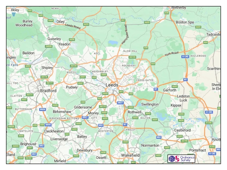
Now heading home – tracking NE from Leeds city centre …
Heading home
(c) Ordnance Survey
Reaching 'terra cognita' at last …

North East Leeds
(c) Ordnance Survey
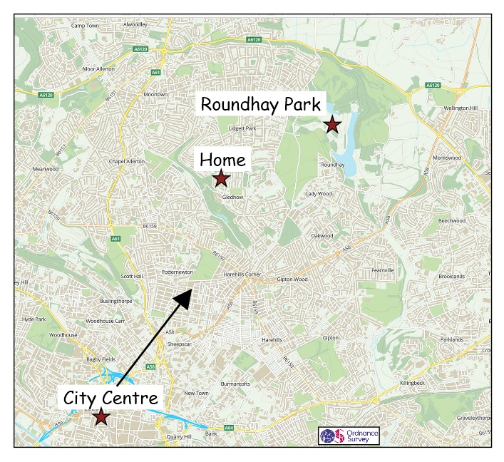
And finally this is the area I call home – it's 'my space' – although, as you can see, our house is perched on its edge, not in its centre …

The area I call home!
(c) Ordnance Survey
Later Chapters #1
It’s not relevant to this chapter of the story of 'Gledhow and Me' but it's interesting to note that Leeds has always been an outward-looking city, even though it’s over 60 miles (100km) from the coast, in both directions (east and west).
In 1704 the Aire and Calder rivers were made navigable to Hull in the east (strictly it’s Kingston upon Hull) allowing the export of woollen goods to Europe. And, similarly, the Leeds-Liverpool Canal was opened in 1816 connecting Leeds to the west coast and thence to America.
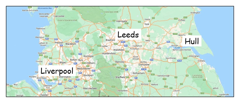
Leeds with Hull to the east and Liverpool to the west
(c) Ordnance Survey
Later Chapters #2
The history of Roundhay Park will also feature in later chapters including its sale, in 1871, and purchase for the town by Sir John Barran and colleagues.

The sale plan for Roundhay Park
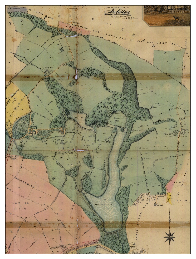
A detail from the sale plan for Roundhay Park