
End Piece
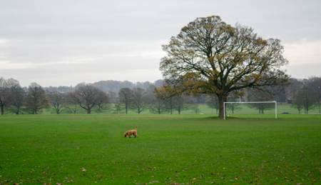
Soldiers’ Field in Roundhay Park is high up and flat
It was used for test flights in WW1 and as a civil aerodrome until 1920
Overall, this ‘feet-on approach’ – my examination of the ‘lie of the land’ – highlighted the way that this area is defined by its topography, but also the extent to which we take these physical features for granted. On the western edge, for example, Gledhow Valley (and Meanwood Valley, it’s more westerly companion) simply interrupts our smooth, direct passage across to Headingley. Similarly, on the southern edge there’s a tall rock-face behind Tesco Supermarket and another, just a few hundred yards away, behind (what was) Safeway Supermarket, and I now know that these are the visible remains of old quarries used to extract Elland Flags sandstone. But previously, this was just an unseen, unquestioned backdrop to the supermarkets whilst two other facts seemed far more note‑worthy:
The first, that Tesco is built on the old site of the Olympia Works of The Blackburn Aeroplane and Motor Co. (which ran test flights from Soldiers’ Field in WW1 and where the roofs of later buildings still sported camouflage paint from WW2, well into the 70s)
And the second, that the steep walk back up the hill from the supermarket is a compelling reason to do our shopping with the car, and not on foot!
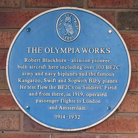
Blue plaque for Blackburn’s Olympia Works
© Wikipedia
So now there was a raft of new questions bubbling up in my mind about ‘my space’, the inner-lands, the edge-lands and the outer-lands. For example, are these sections different in the way they look and ‘feel’? What are they used for? And what’s the relationship between them?
It was time to study them individually and then explore the relationship between them all. Well, that seemed like a plan!
I’ll let you know when I've more to report.
Stay safe xxxx