
On to Topography
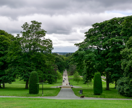
Looking down through Roundhay Park to the city in the far distance
I started my study into the local ‘topography’ by thinking about the way we move around the area – where we drive, the bus routes we take and particularly where we walk – the feet-on approach! And at first this felt an awkward methodology because it was such an unfamiliar way of thinking about my locality (though perhaps that was the point of this project – turning my pragmatic, functional, un‑thinking relationship with Gledhow/Roundhay into deeper recognition, enabling me to live ‘in’ the neighbourhood not ‘on’ it). But I became more confident with the approach when, firstly I found a map of the area titled ‘Movement’ (below) in the ‘Roundhay Ward Neighbourhood Design Statement’ (more of this design statement later – this ‘NDS’) which was presented to the Leeds City Council as a Supplementary Planning Document. And secondly when I imagined us standing in the middle of Roundhay Park, surveying our realm! This mental-mapping reminded me that we’re high up – high enough that there was an airport here in the early part of the 20th century. And I realised I could stand and look straight across the city to Emley Moor mast, the transmitting station 20 miles to the south (or maybe it’s the more westerly Holme Moss mast – I’ll take a compass with me next time and find out).
Then, the strangest feeling, even as I write about the compass, I’m aware that my sense of appreciation and engagement with the locality is already changing – I’ve become more curious, more involved. I want to learn more, understand more.
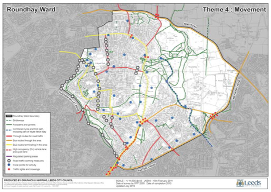
The ‘Movement Map’ showing bridleways, footpaths, ginnels,
through-routes, bus routes, cycle lanes and traffic calming
© Graphics & Mapping, Leeds City Council
Returning to my ‘feet-on approach’, I mentally connected with the old practice of ‘beating the bounds’ (as in ancient times before maps) and this, in turn, led me to consider all the people who have settled here across the centuries – why they came here, and the ‘paths they trod’, how they had moved around. (For this, I looked at the local turnpikes and the development of suburban passenger transport i.e. horse buses, trams, and modern buses, courtesy of the Leeds Transport Historical Society). And it became increasingly evident that the local topography had always been the factor that determined the patterns of movement in the past and continues to do so in the present.
[I’ll talk about ‘beating the bounds’ more extensively in a later chapter].
As soon as I recognized this, it was blindingly obvious that topography is important because it’s something we know from personal experience! The thriving community of Chapel Allerton is less than a mile away ‘as the crow flies’ but is separated from us by Gledhow Valley – a valley that is so steeply-sided I can only remember walking across it once in the 47 years we’ve lived here (to enjoy the Grand Depart of the Tour de France in 2014, with our Matthew and his closest friends).